DroneDeploy
New software applies machine learning to drone imagery
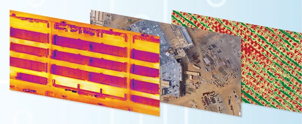
Map Engine (photo) is a new machine-learning-driven photogrammetry software that generates high-resolution maps and 3-D models from drone imagery. The new processing engine leverages the latest cloud infrastructure and machine-learning technology to deliver high-quality results and help users reduce hardware and maintenance costs, says the company. The new Map Engine release now generates maps and models 30–50% faster than previous versions of the software, says the developer. Scenes made up of hundreds of images can be processed in under an hour. Mobile-upload capabilities enable users to wirelessly transfer images to the cloud. — DroneDeploy, San Francisco, Calif.